
Hike&Climb
Follow us on
E-mail
Main office address

Via Colombo 7/27 - GENOA
tel. +39 347 0345016
16121
Italy
The Outdoor Ligurian Choice
© Hike&Climb

Day trips
The pure and simple act of setting out to take a pleasant hike among the wonders of our land in the course of a single day.
The act of walking immerses you in an active form of meditation that engages all the senses; you walk for no reason, simply for the pleasure of savoring the passing of time, to discover unknown places and faces, or even, simply, to answer the call of the road. Walking is a peaceful way to reinvent time and space. It involves a joyful humility before the world.
Going to the mountains is coming home

Lou viol d'es Fiour
The Flower Trail is a nature route in the upper Vallone dell'Arma, between the Stura di Demonte Valley and the Grana Valley.
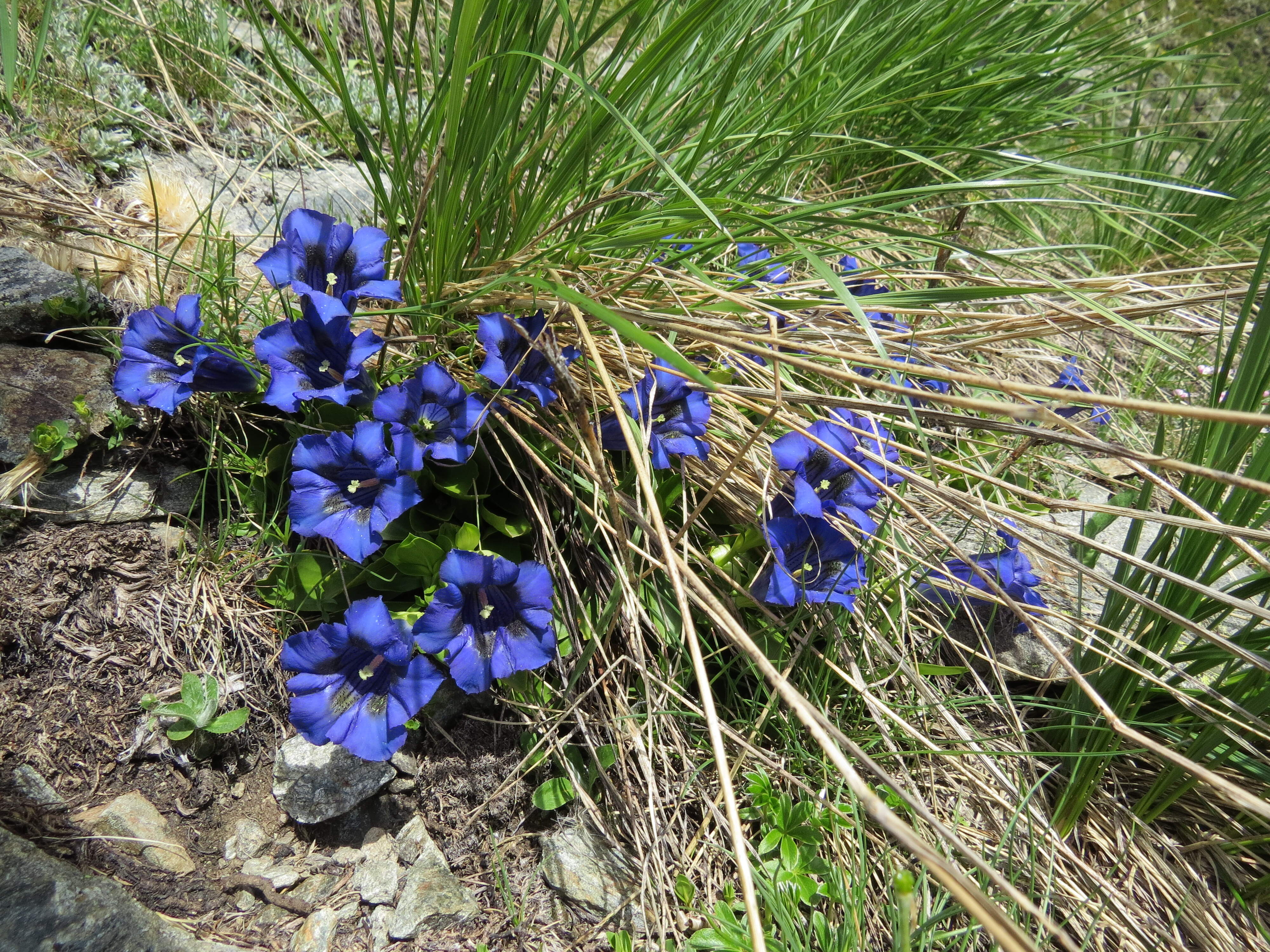
The site is an exceptional treasure trove of biodiversity: green alpine meadows lit up by the bright colors of blooming edelweiss, lilies, orchids, anemones, rhododendrons, gentians, and many other species. The trail winds through a striking karst landscape and is made even more fascinating by the abundant presence of grazing ibex and the panoramic views over the Vallone dell’Arma and the Gardetta Plateau.
- Start: Colle di Valcavera (2416 m)
- Distance: 13.5 km
- Elevation gain +: 760 m
- Duration: 6 h
- Difficulty: E
- Packed lunch (Rifugio Carbonetto a few km from the starting and ending point)
- The hike will be led by AMM Luca Caviglia
For all details and rates contact the guide: luca@hikeandclimb.it - 3397655511

Pilgrims and Brigands
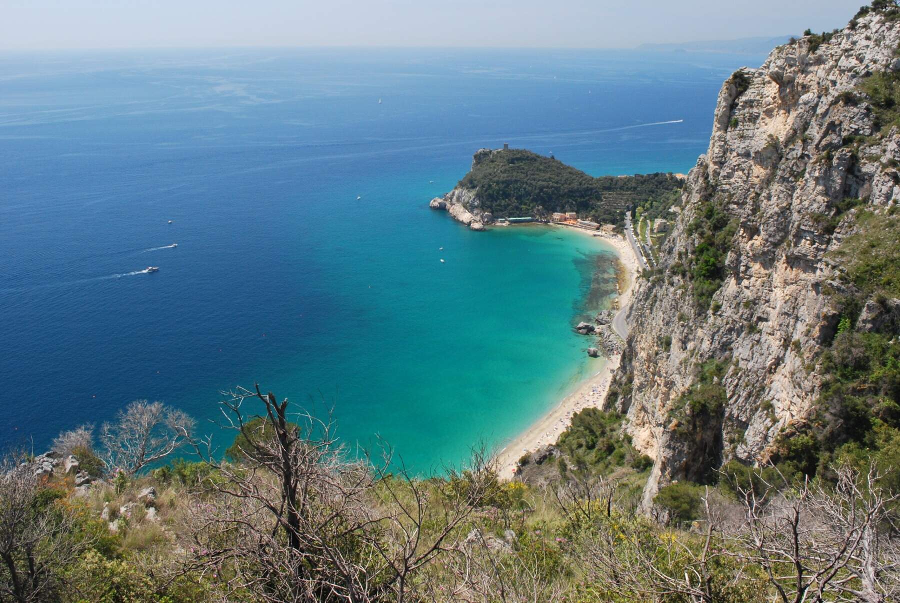
Capo Noli Ring along the Pilgrim's Path
Splendid loop itinerary between Capo Noli and Varigotti, along trails always overlooking the Riviera di Ponente. An uninterrupted viewpoint that fills your eyes with wonder, set in an extremely interesting historical and artistic context.
The hike winds along ancient routes of travel and trade traced by the powerful Maritime Republic of Noli, punctuated along the way by numerous churches, votive chapels, and hermitages that were once pilgrimage destinations and are still largely accessible today.
A simple yet fascinating excursion, along paths swept by the wind and wrapped in Mediterranean scrub, from where you can “watch through the leaves the distant shimmering of sea scales.”
- Departure: Noli
- Distance: 11.5 km
- Elevation gain: 680 m
- Duration: 4 h
- Difficulty: E
- Maximum number of participants: 15
- The hike will be led by AMM Luca Caviglia (luca@hikeandclimb.it - 3397655511)
For all details and rates, contact the guide

Where the chamois dare
Monte Galero Ring
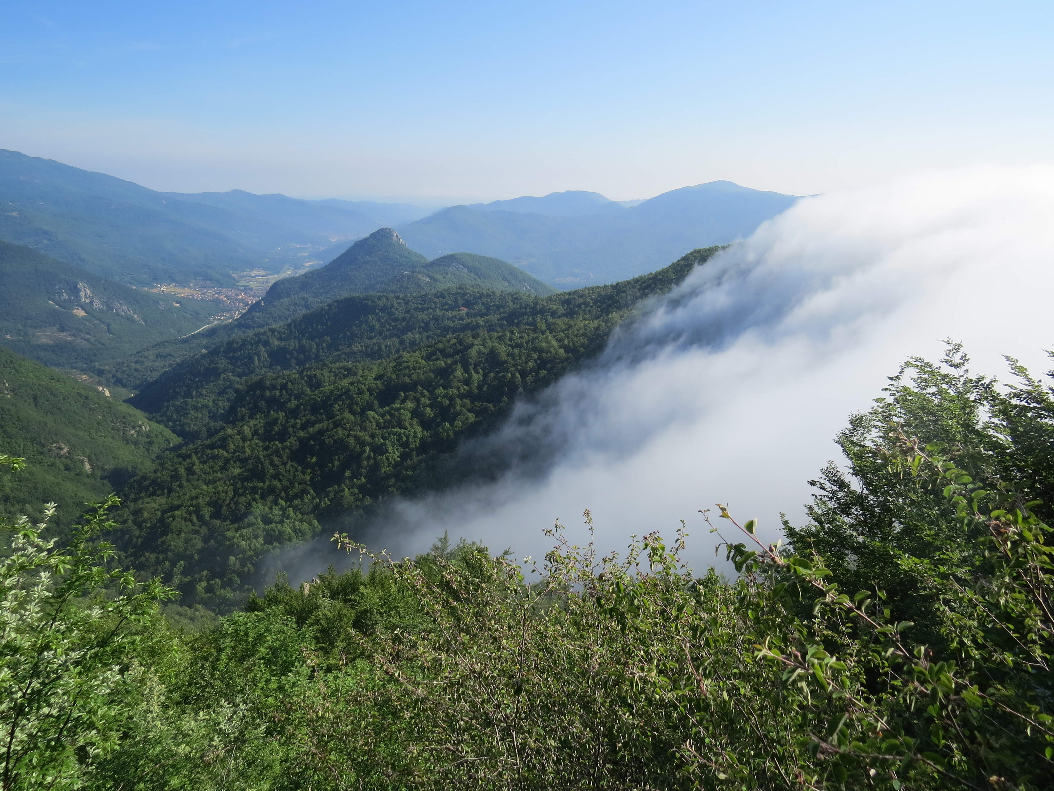
The itinerary includes a succession of sections along the Alta Via dei Monti Liguri and the Via Alpina, completing a loop culminating with the panoramic grassy dome of Monte Galero, on the border ridge that in this stretch separates the Piedmontese Tanaro Valley from the Ligurian Neva and Pennavàira Valleys. In addition to the breathtaking panorama stretching from the sea of Albenga to the peaks of the Ligurian Alps, the mountain offers a perfect blend of Mediterranean, Alpine, and continental environments. In fact, its slopes represent the southeastern limit of the range of two Alpine species, the chamois and the marmot, offering the unique opportunity to observe one of these animals silhouetted against the backdrop of the Ligurian Sea.
Walking along the trails of Monte Galero feels like strolling through the corridors of an open-air natural history museum, where glacial flowers grow in the shadow of peculiar stone giants and the many woodland inhabitants pilgrimage to enchanting springs, aptly named “of wonders.”
Start: Colle San Bernardo di Garessio (957 m) (CN)
Distance: 14 km
Elevation gain +: 910 m
Duration: 6 h
Difficulty: E
Refreshment points: No
- Maximum number of participants: 15
- Fee: €20 per person
The hike will be led by AMM Luca Caviglia (luca@hikeandclimb.it - 3397655511)

In the Presence of Giants
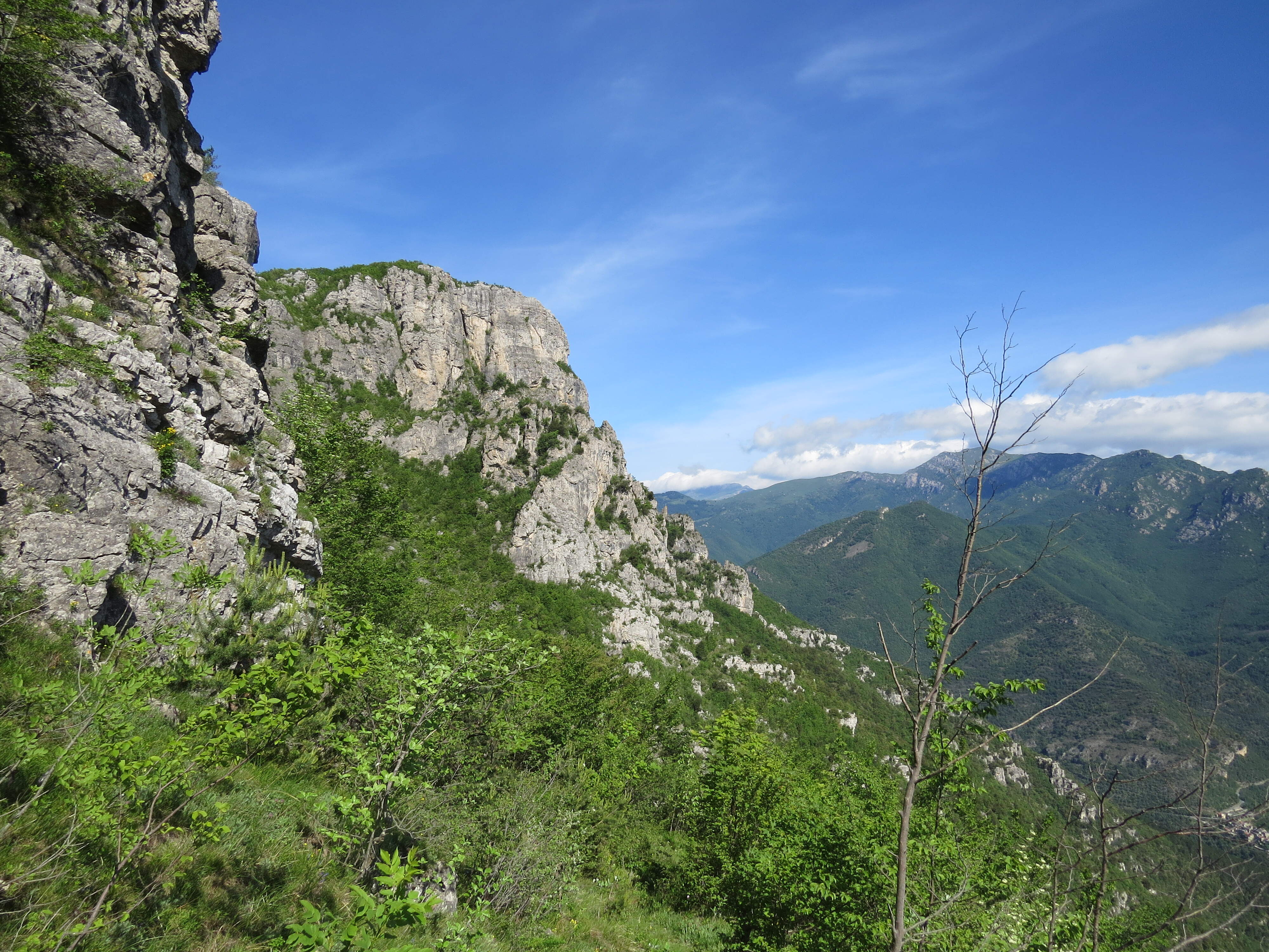
Monte Nero Ring
itinerary of notable historical interest and undeniable scenic value centered around the route of the Sentiero dei Giganti, a hiking “gem” that is little known but has nothing to envy compared to much more celebrated Dolomite routes. The trail winds along ledges overlooking the Val Pennavaira, running at the base of the dizzying towers of Monte Pendino and Monte Nero, gentle giants guarding the valley.
Splendid views of the Piana di Albenga and the peaks of the Ligurian Alps frame the entire route.
- Departure: Castellaro hamlet (265 m) – Vendone (SV)
- Distance: 14.4 km
- Elevation gain +: 1160 m
- Hiking time: 6 - 7 h
- Difficulty: EE (Expert hikers)
- Refreshment point: No
- Maximum number of participants: 10
- Fee: €25 per person
- The hike will be led by AMM Luca Caviglia (luca@hikeandclimb.it - 3397655511)
Hike&Climb
Follow us on
E-mail
Main office address
Via Colombo 7/27 - GENOA
tel. +39 347 0345016
16121
Italy
The Outdoor Ligurian Choice
© Hike&Climb